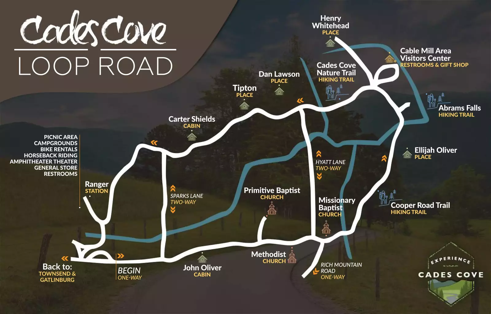
Cades Cove Loop Road
John Oliver Cabin
Primitive Baptist Church
Methodist Church
Missionary Baptist Church
Cooper Road Trailhead
Elijah Oliver Place
Abrams Falls Trailhead
Cades Cove Visitor Center
John P. Cable Mill
Henry Whitehead Place
Cades Cove Nature Trail
Dan Lawson Place
Tipton Place
Cantilever Barn
Carter Shields Cabin
If you're looking for an interactive Cades Cove map and directions to Cades Cove, use the one from Google Maps below:
Directions To The Cades Cove Loop
Cades Cove Loop is accessed by Laurel Creek Road. This road is the only driving entrance to the one-way loop. To get to Laurel Creek Road from where you are, follow these directions.
- Follow the main Parkway to the Great Smoky Mountains National Park
- Take a right on Little River Road after the Sugarlands Visitor Center
- Stay on Little River Road for about 20 miles
- Continue onto Laurel Creek Road and into Cades Cove
- Take the Pigeon Forge Parkway to Traffic Light #3 to Wears Valley Road
- Take 321 to Townsend
- Take TN-73 E into the Great Smoky Mountains National Park
- Head southwest on Laurel Creek Road until you reach Cades Cove
Location
Miles to Cades Cove
Townsend
11
Pigeon Forge
26
Maryville
28
Gatlinburg
29
Knoxville
45
Lenoir City
47
Asheville
109
Tips for Driving Through Cades Cove
Visit early in the morning or late in the evening. The Cades Cove Loop is open from sunrise to sunset. If you’re driving the loop around those times, you’ll have less crowds and a better chance of seeing wildlife.
Be prepared to stop. Cades Cove is not a quick drive. Be prepared to go slow around the loop and to make frequent stops as cars around you take time to see the sights.
Pack a picnic. You can pull off at the Cades Cove picnic area and enjoy lunch surrounded by the beauty that Cades Cove has to offer. Just be sure to pick up your trash and to never leave food unattended to protect wildlife.
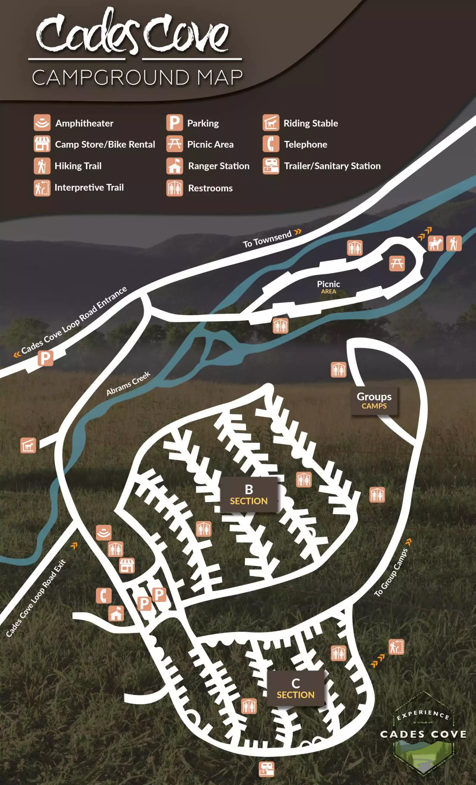
Cades Cove Campground Map
Extend your time in Cades Cove by staying at the Cades Cove Campground! Use our Cades Cove Campground Map to become familiar with the area and see where to park, where the campsites are, and what things are nearby.